

LOCATE
How to Read This Terrain
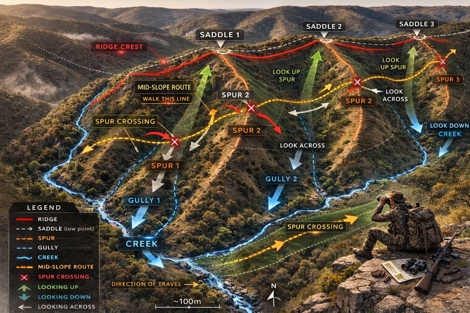
This country is structured around one main ridge, with multiple spurs dropping down into the creek below.
Between each spur is a gully.
Where two spurs connect along the ridge, you’ll find a saddle.
Understanding these features is key.
Ridge – the high ground along the top.
Saddle – the low point between two high points on the ridge.
Spur – a finger of high ground running downhill.
Gully – the drainage between spurs, often feeding into the creek.
Creek – the main movement corridor at the bottom.
The Travel Line
The most efficient route is the mid-slope band — between the creek and the saddle line.
Not on the ridge.
Not in the bottom.
In the middle.
From this elevation you can:
Look down into the gullies.
Look up toward the saddles.
Look across onto the next spur.
You cross each spur deliberately.
You cut into each gully.
Then return to the mid-slope line and repeat.
Why This Works
Too high and you lose visibility into the drainage.
Too low and you lose visibility toward the saddle.
Mid-elevation gives you control of both.
It allows:
Better wind management.
More glassing angles.
More intercept opportunities.
Work the contour.
Cross each spur.
Stay between the creek and the saddle.
Most efficient way to hunt a system.